When you are walking around in the Stoke neighbourhood, you might have noticed lots of very high stone walls… Richard Fisher helped us to find out where these came from, and why they are so high!
200 years ago, the whole area of Stoke, Ford & Keyham would have been green countryside, with very few houses or other buildings.
When we look at maps and paintings from the time, we can start to imagine just how rural the area was in the past. The amount of green space available made the area an attractive place to live and build houses!
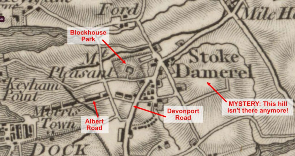
We can see on an early map from 18091 that there were a few walled settlements or houses with walls around the land that surrounds them, and a hill or high place on the site where City Business Park is today. This practice of building a high wall around one’s house and land would have been commonplace at the time (to de-mark boundaries, and keep unwanted visitors, animals, and potential thieves out).
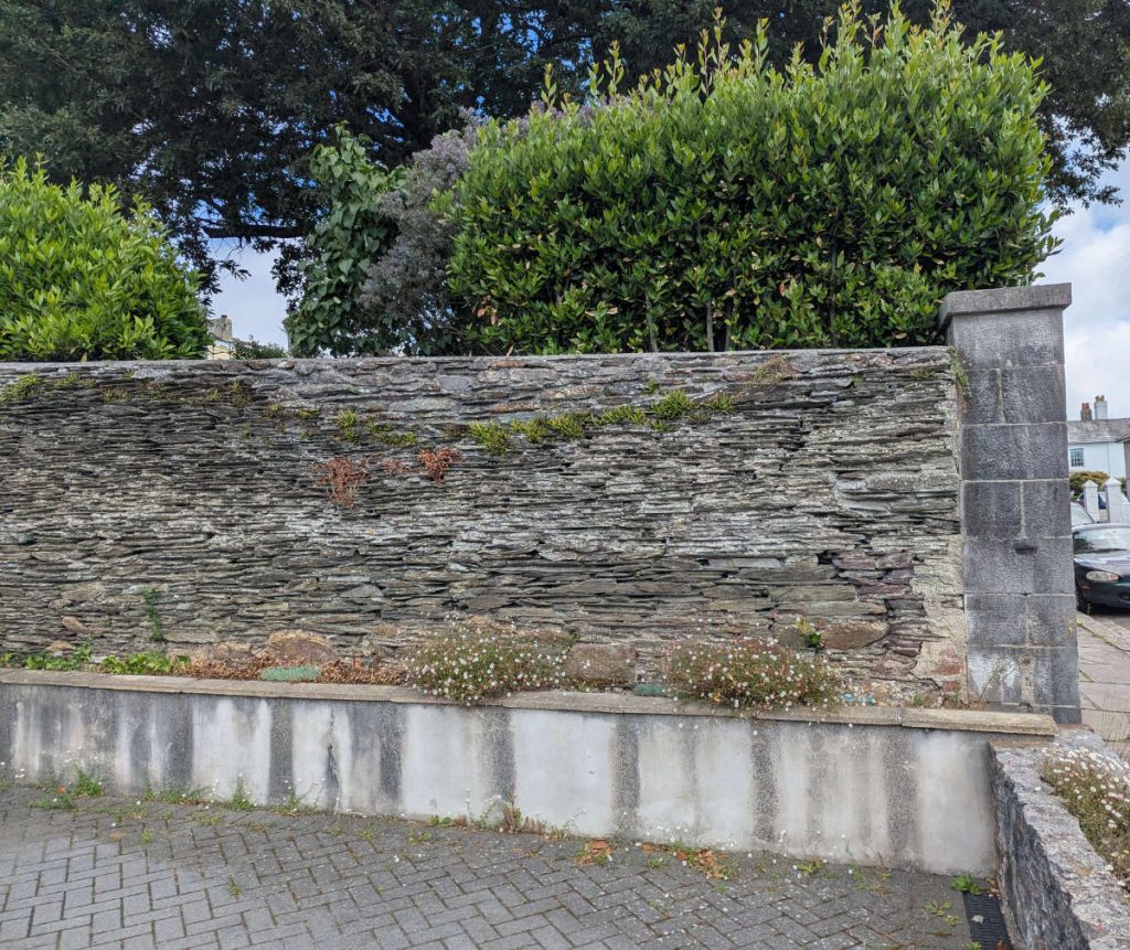
Example of a historic shillet wall on Somerset Place in Stoke Village. This would have been part of an old boundary wall around a house with land.
We can see from the OS Geological survey map2 from 100 years later that the underling rocks in the areas all around Stoke are classified as “Slates” (formed in the Upper Devonian period – around 385 to 359 million years ago), with one small area around Blockhouse Park classified as “Volcanic Rocks”.
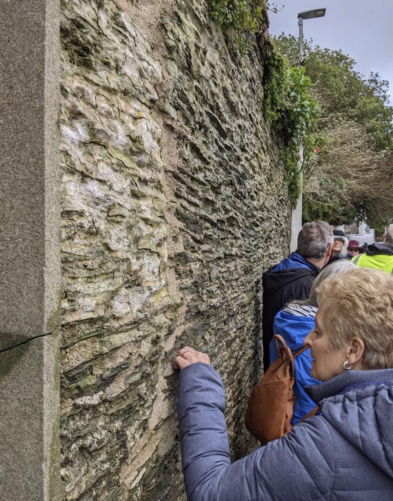
When we look at the high walls in Stoke today, we can see that they are made using some kind of green-ish slate – laid flat, in layers on top of one another, with lots of mortar.
This slate is often known locally as “shillet” – a south-west dialect word that describes slaty type rocks, often used as a building material.
The shillet stone for these walls in Stoke would most likely have come from just down the road at Penlee Quarry!
Closer view of shillet wall around the boundary of Belmont House (see from Somerset Place), with repairs / older and newer areas.
Penlee Quarry, Stoke
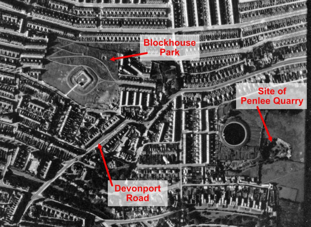
In later maps, like the 1905 OS map of the area, we can see a large area marked as “Penlee Quarry”, where the bungalows on Somerset Place and Stoke Damerel Community College stand today. There is also a map of Penlee Quarry listed in the St Aubyn Estate Plans3 held at The Box’s archive.
This aerial photograph of the area shows the Penlee Quarry site on Somerset Place (around 1941), but it unclear whether or not the quarry was still in use at this point.
Contributors:
- Richard Fisher
- Rachel Dobbs
References:
- Sheet XXIV Surveyed: 1784 to 1804, Published: 1809 – available online at https://maps.nls.uk/view/257576666 ↩︎
- Sheet 348 – Plymouth (1 inch to the mile, Drift) OS revised: 1894, Geological Survey published: 1907, Reprinted: 1950 – available online at https://maps.nls.uk/view/240946548 ↩︎
- Catalogue description – Penlee Quarry (19th Century) – https://discovery.nationalarchives.gov.uk/details/r/b3f2d29f-4129-401d-94ea-3a434fe08090 ↩︎